
Use Case 1 – Crop Yield Prediction and Land Bonitation
Combining soil studies, GIS and machine learning to evaluate land potential and forecast agricultural yields.

Overview
Use Case 1 of the COSA project targets one of the most foundational questions in agriculture: how can we accurately, dynamically and at scale evaluate the real potential of a piece of land and forecast the yield it can deliver? The use case combines classical agronomic land bonitation with modern Geographic Information Systems (GIS) and machine-learning models, and validates the resulting framework on real Romanian agricultural data.
Scope
The use case integrates several streams of work:
- Soil and land studies — pedological studies, land bonitation tables and historical cadastral data are processed and harmonised as input for the COSA framework.
- GIS-driven land evaluation — cadastral information, soil maps, topography and climate data are combined in a GIS environment to compute spatially aware bonitation scores at the level of individual fields.
- Machine-learning enhanced bonitation — adaptive models continuously analyse complex spatial and environmental data to evaluate land potential dynamically and to keep up with a changing climate.
- Crop yield prediction — supervised models predict crop yields based on agronomic and environmental indicators, supporting both farmers and policy-makers.
- Crop management optimisation — fertilisation and crop-management strategies are optimised for specific crops and regional contexts (e.g. triticale in the Lăpuș depression).
Methodology
The use case follows a layered approach consistent with the overall COSA architecture:
- Data layer — pedological studies, land bonitation tables, cadastral and amenajament documents, GIS layers and weather time series are ingested and structured.
- Modelling layer — feature-selection methods are used to identify the most relevant variables for soil moisture and precipitation prediction, and deep-learning artificial neural networks are then trained for environmental forecasting.
- Decision layer — the resulting models feed into a GIS-driven, machine-learning-enhanced framework for adaptive land bonitation that produces up-to-date land quality scores and crop recommendations.
Background materials
Use Case 1 builds on a curated set of agronomic and methodological references, including: pedological studies (e.g. Tinosu commune), official land bonitation tables, methodological references on agronomic land evaluation, soil moisture and humidity algorithms, cadastral and amenajament documents, and prior doctoral research on land evaluation using GIS.
Live platform
The work of Use Case 1 is materialized in the Land Bonitation Platform, a publicly accessible GIS application developed by Bogdan Văduva in partnership with Vital.
Selected publications produced in this use case
- M. T. Sattari, A. Avram, H. Apaydin, O. Matei, «Evaluation of Feature Selection Methods in Estimation of Precipitation Based on Deep Learning Artificial Neural Networks,» Water Resources Management, Springer, 2023. (Q1)
- I. Cionca, A. D. Costin, T. Rusu, «Optimizing fertilization and crop management for triticale in the Lăpuș depression, Romania,» AgroLife Scientific Journal, 2024.
- C. Anton, A. Avram, O. Matei, L. Andreica, B. Văduva, «Advancements in Machine Learning Algorithms for Precision Crop Yield Prediction: A Comprehensive Review with Focus on European Union,» SOCO 2024.
- B. Văduva, O. Matei, A. Avram, L. Andreica, «Embedding GIS in crop field bonitation computation,» SOCO 2024.
- B. Văduva, A. Avram, O. Matei, L. Andreica, T. Rusu, «A GIS-Driven, Machine Learning-Enhanced Framework for Adaptive Land Bonitation,» Agriculture, MDPI, 2025. (Q1)
- I. Băărăian et al., «Trend-Enabled Recommender System with Diversity Enhancer for Crop Recommendation,» Agriculture, MDPI, 2025. (Q1)
- O. S. Mintas et al., «Sustainability of the Integrated Waste Management System: A Case Study of Bihor County, Romania,» Sustainability (Basel), MDPI, 2025.
Expected impact
- Precision crop matching — farmers can match crop varieties to the optimal soil conditions of each specific parcel.
- Dynamic adaptation — as climate, rainfall and soil conditions evolve, the machine-learning models adapt and continue to deliver accurate, future-proof land-quality scores.
- Sustainable land management — the data-driven approach helps prevent land degradation and over-farming, supporting productive and environmentally sustainable agricultural practices.
Publications related to UC1 — Crop Yield & Land Bonitation
A GIS-Driven, Machine Learning-Enhanced Framework for Adaptive Land Bonitation
A GIS-Driven, Machine Learning-Enhanced Framework for Adaptive Land BonitationBogdan Văduva, Anca Avram, Oliviu Matei, Laura Andreica, Teodor Rusu Abstract. Traditional land bonitation, the agronomic evaluation of land quality and agricultural potential, often relies...
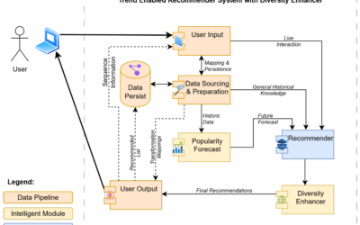
Trend-Enabled Recommender System with Diversity Enhancer for Crop Recommendation
The generalized traveling salesman problem (GTSP) is an extension of the classical traveling salesman
problem (TSP), and it is among the most researched combinatorial optimization problems due to its theoretical properties, complexity aspects, and real-life applications in various areas: location-routing problems, material flow design problem, distribution of medical supplies, urban waste collection management, airport selection and routing the courier airplanes, image retrieval and ranking, digital garment manufacturing, etc.
Sustainability of the Integrated Waste Management System: A Case Study of Bihor County, Romania
Sustainability of the Integrated Waste Management System: A Case Study of Bihor County, RomaniaOlimpia Smaranda Mintas, Daniela Camelia Marele, Alina Stefania Stanciu, Adrian Gheorghe Osicianu, Alina Stanca Osiceanu, Horia Pop, Teodor Rusu Abstract. Integrated waste...
Optimizing fertilization and crop management for triticale in the Lăpuș depression, Romania
Optimizing fertilization and crop management for triticale in the Lăpuș depression, RomaniaI. Cionca, A. D. Costin, T. Rusu Abstract. Triticale is an important cereal crop in mountainous and hilly areas of Romania, where soil and climatic conditions can limit the...
Advancements in Machine Learning Algorithms for Precision Crop Yield Prediction: A Comprehensive Review with focus on European Union
Advancements in Machine Learning Algorithms for Precision Crop Yield Prediction: A Comprehensive Review with focus on European UnionCarmen Anton, Anca Avram, Oliviu Matei, Laura Andreica, Bogdan Văduva Abstract. Accurate crop yield prediction is a key enabler of...
Embedding GIS in crop field bonitation computation
Embedding GIS in crop field bonitation computationBogdan Văduva, Oliviu Matei, Anca Avram, Laura Andreica Abstract. Crop field bonitation, the agronomic evaluation of land quality and agricultural potential, traditionally relies on tabular indicators that ignore the...
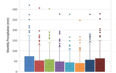
Evaluation of Feature Selection Methods in Estimation of Precipitation Based on Deep Learning Artificial Neural Networks
Precipitation is the most important element of the water cycle and an indispensable element of water resources management. This paper aims to model the monthly precipitation in 8 precipitation observation stations. The effects and role of different feature weights pre-processing methods (Weight by deviation, Weight by PCA, Weight by correlation, and Weight by Support Vector Machine) on artificial intelligence modeling were investigated.